
Campus Map Services
Nestled in the heart of Orange County, the University of California, Irvine is located in one of the safest large cities in the nation. UCI students, faculty and staff come together on the campus's 1,478 acres to be the driving force of innovation and discovery that benefits our community. Visitors can experience the vibrant campus life of 33,000+ students for themselves by using the 405 freeway or 73 tollway, or taking one of four OCTA bus routes that service our campus.
UCI Transportation is here to make your visit to our campus the best experience possible with various campus map options for you to use. Feel free to explore the interactive maps, or view the blue campus maps.
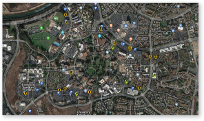
Interactive Maps
UCI Interactive Map
Parking Permit Map
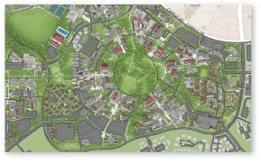
Blue Campus Maps
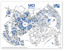
Main Campus (PDF)
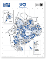
Campus Core (PDF)
Departments may order blue campus map pads on our Supply Order Form.
Driving Directions to UCI
405 Freeway
From the North:- Exit at Jamboree Rd.
- Right on Jamboree Rd.
- Left on Campus Dr.
- Right on West Peltason into UCI
- Exit at University Dr.
- Left on University Dr.
- Left on Campus Dr.
- Right on West Peltason into UCI
73 Freeway / Tollway
From the North:- Exit at Bison Ave.
- Left on Bison Ave. into UCI
- Exit at Bison Ave.
- Right on Bison Ave. into UCI
5 Freeway
From the North:- Take 5 South to 55 South to 73 South
- Exit at Bison Ave.
- Left on Bison Ave. into UCI
- Take 5 North to 405 North
- Exit at University Dr.
- Left on University Dr.
- Left on Campus Dr.
- Right on West Peltason Dr. into UCI
55 Freeway
From the North:- Take 55 South to 73 South
- Exit at Bison Ave.
- Left on Bison Ave. into UCI
- Take 55 North to 73 South
- Exit at Bison Ave.
- Left on Bison Ave. into UCI
91 Freeway / 261 Tollway
From the North:- Take 91 West to 241 South to 261 South (portions toll)
- 261 becomes Jamboree Rd.
- Left on Campus Dr.
- Right on West Peltason Dr. into UCI